
Follow this captivating 10km circular route around the magical Holy Island – something everybody needs to do at least once in their lifetime, in my opinion.
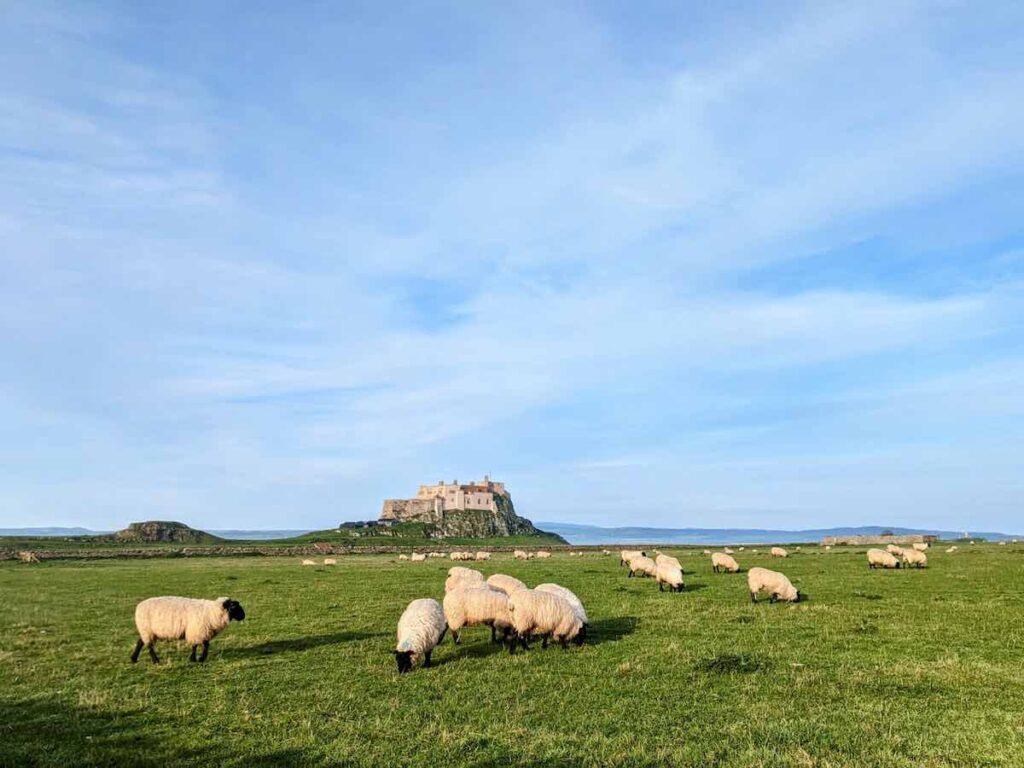
Expect remote beaches and whispery dunes, solo encounters with wildlife and majestic markers, such as Lindisfarne Castle, perched on top of a volcanic plug making it easy to find your way round.
Related reading: How to Start Trail Running
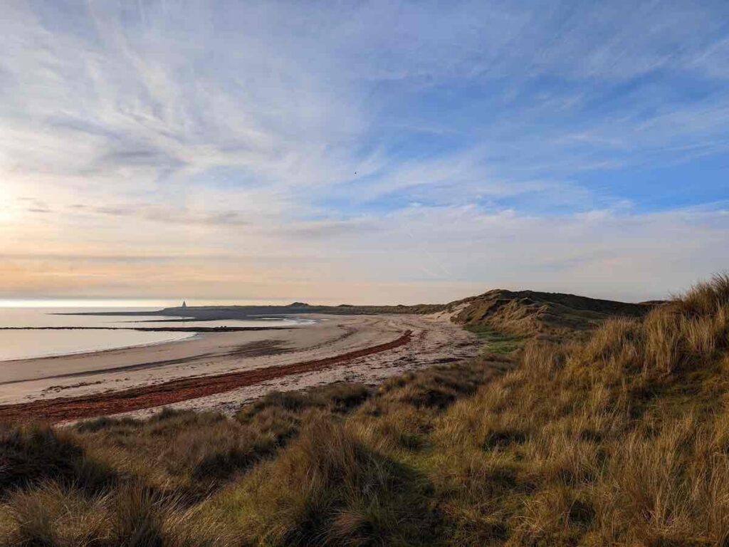
Holy Island north beaches and castle at sunrise
This one-of-a-kind tidal island had been on my UK trail running bucket list for a long time. Mystical, magical and metaphysical. I chose to run Holy Island, but you can easily walk it too.
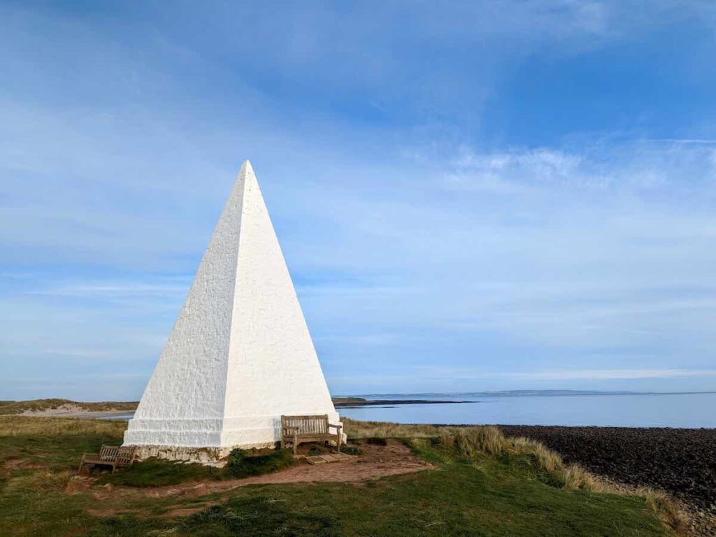
Setting of at 5am (I’m an early riser who loves a morning run and wanted to avoid running in hot weather) I felt like I had the entire island to myself. With a population of only 180, this wasn’t too far from the truth! You’ll take in Lindisfarne Castle, Emmanuel Head pyramid (below), countless beaches, lime kilns, and the Holy Island priory.
I thought I’d post a quick step-by-step route guide so others can experience the magic too…
A bit of background about Holy Island
Holy Island is a pint-sized place of unrivaled beauty, expansive beaches, and hushed tranquillity.
Pilgrims came for centuries, now its 650,000 walkers and day tourists every day. It’s easy to see why. Writers, poets and lost souls flock there too, with the landscape a constant source of inspiration and said to have therapeutic qualities.
Holy Island’s history dates back to 6th century AD; first as an important site of early English Christianity and pilgrims, followed by Viking raids, fishing industry and now as Area of Outstanding Natural Beauty and a hotspot for historical tourism and bird watching.
It’s a stunning stretch of the Northumberland coast that will stay with me for a long time.
Holy Island walking route details
Distance: 6 miles (9.7km)
Time: 2-3 hours walking, 40-60 minutes running
Ease: Moderate (mixed terrain, steep in places)
Start and end point: Chare Ends car park (postcode: TD15 2SE)
Terrain: Sandy dunes, grass paths and pebbled beaches
Footwear: Hiking boots or trail running shoes
💌 Inspiring Run Stories.. in Your Inbox
How to cross Lindisfarne causeway – safe crossing times
Lindisfarne is connected to the the north of England by a 3 mile long causeway: twice-daily tides make access to the mainland possible for only 14 hours a day. The tidal island even has ‘refuge boxes’ for people caught by the tide (don’t be one of them!). Below is my crossing at sunrise.

Driving takes across Holy Island causeway takes approximately 10 minutes. Check the safe crossing times before you travel.
Walking across Holy Island causeway takes about 2 hours. If on foot, ideally set off two hours before low tide. Never cross against a rising tide.
Walking across the Pilgrim’s route onto Holy Island is also possible, retracing their steps by following the poles in the sand, however it takes longer and requires a much more caution and research (more info).
Let’s go… 10km step-by-step route around Lindisfarne
- The walk starts from the main visitor car park on Chare Ends.
- Exit the car park (via the exit, not the entrance) and cross over on to the path on the other side of the road. Join the main road, veering right, as if you’re leaving the village and island.
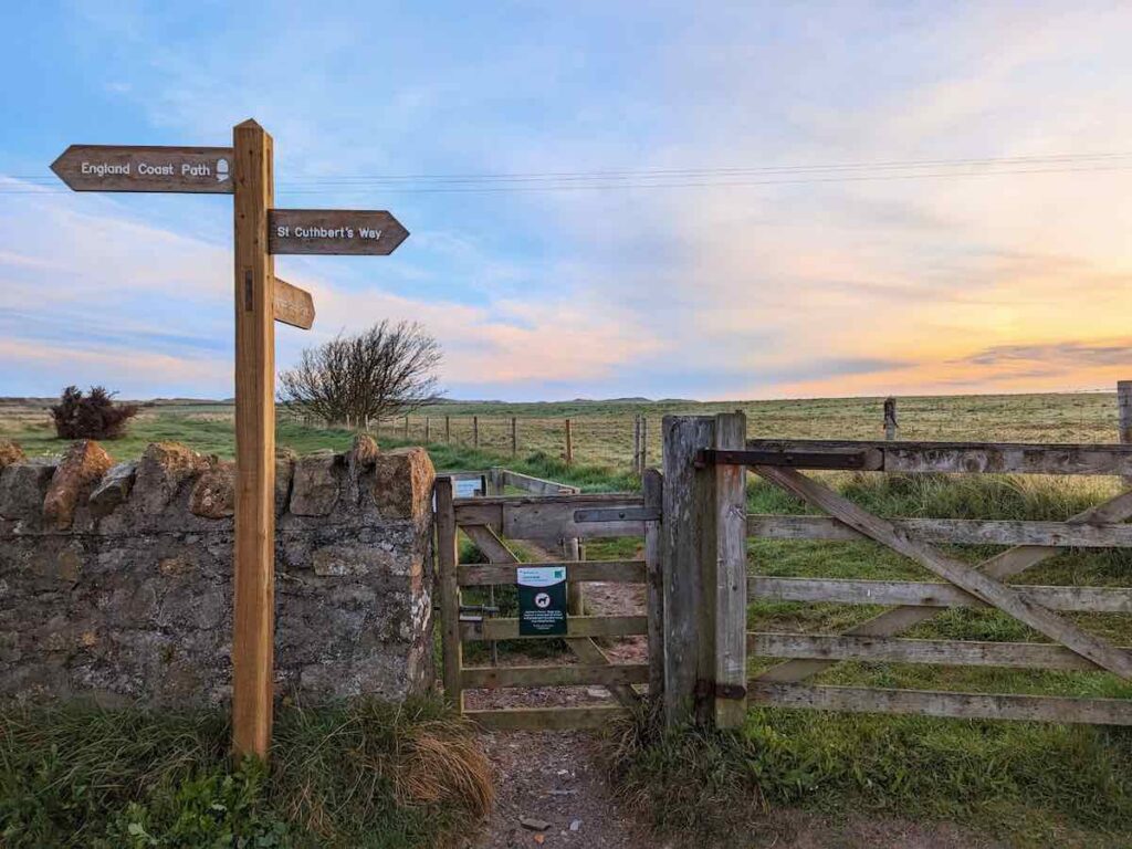
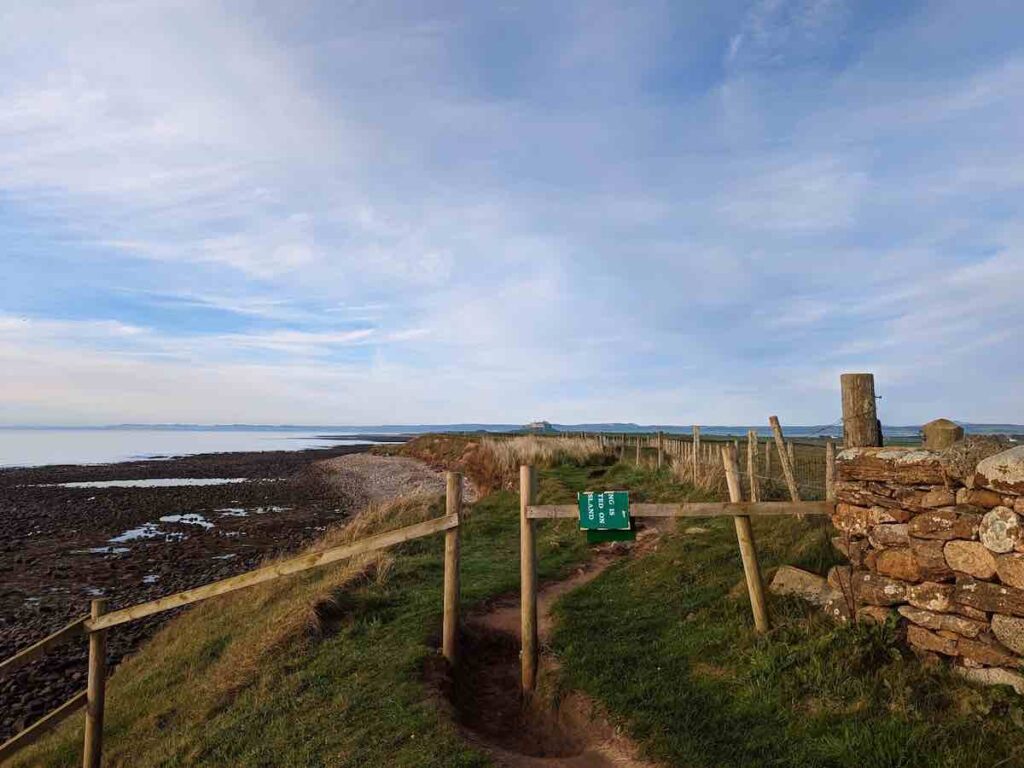
- Approximately 30 metres down the road is a gate with navigational sign pointing to ‘England Coastal Path’. Pass through and take the path hugging the fence-line on its right, the intertidal sand and mud flats on your far left. Keep your eyes peeled for deer, as I was lucky to see a pair happily bounding here.
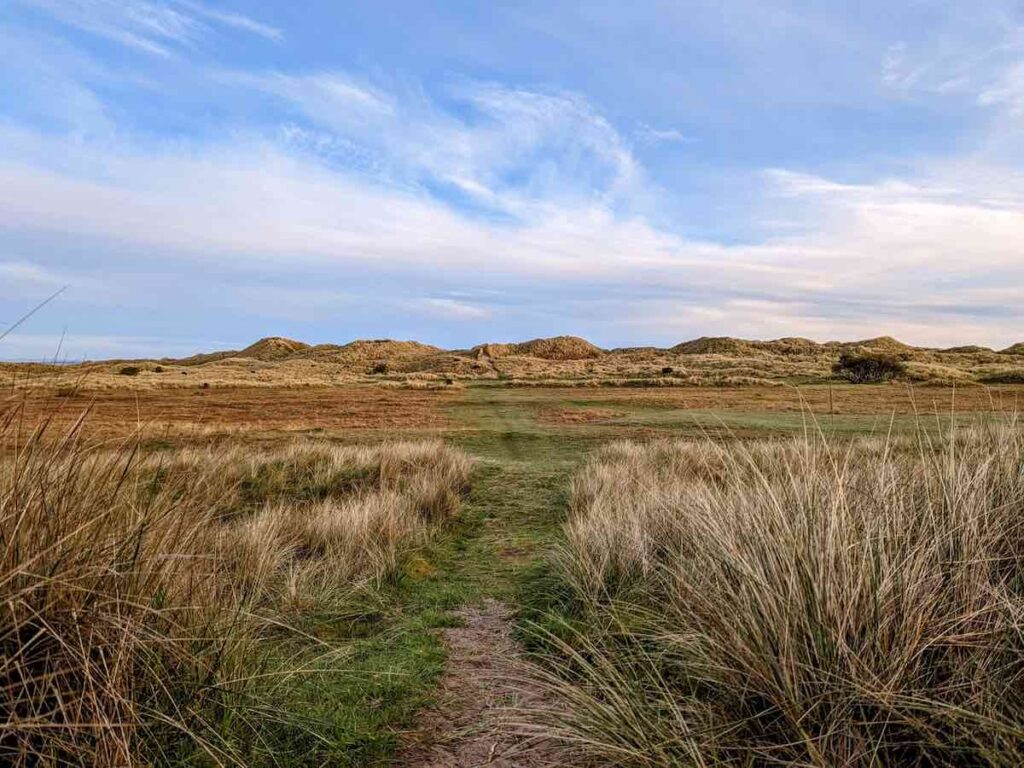
- The path soon opens up and hits a crossroads. This is the only disorientating part of the run or walk around Lindisfarne, however simply head straight towards the dunes.
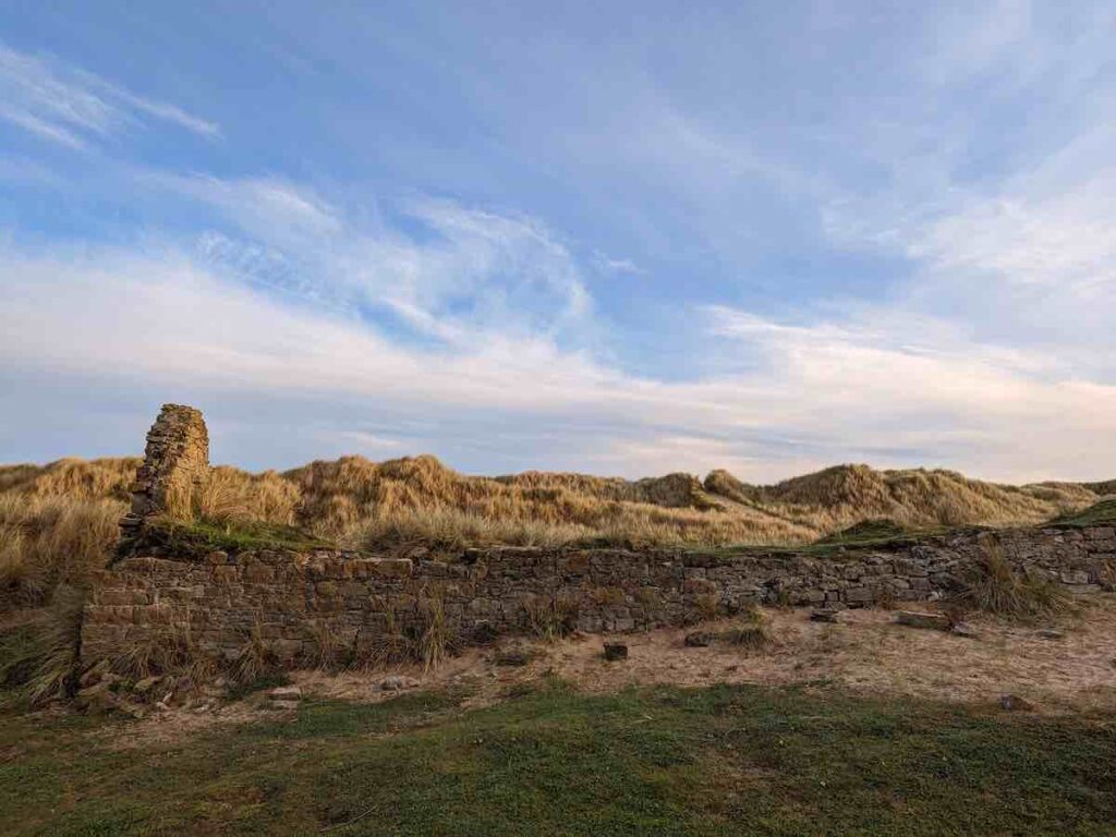
- At the crest of the first set of dunes you’ll see the ruins of a building. Follow the path, taking the left fork, into the next open area.
- Keep going straight, following the worn path over the next set of dunes.
- You’ll encounter another set of ruins, passing them on your right and through the gap in the wire fence. Ahead of you is the North Shore of Lindisfarne island. Spacious, endless and flat to the left, however it’s the shorter stroll to the right you’re taking.
- The beach soon becomes rocky. Keep going a little further and exit the beach at the gated point in the picture below. It’s a semi-steep climb back into the winding dunes, keeping the shoreline to your left.
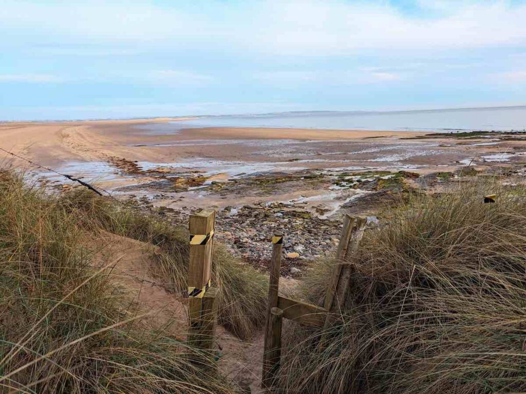
- Follow this undulating path for half a mile or so. It’s here that I saw a colony of seals, hearing them signing first. Don’t fret that the path is dragging you inland on occasion as it soon weaves back to the crest of the dune. Before you know it you’ll reach the next beach, Coves Haven, with a short descent onto rocks to access it.Backed by high sand dunes there are steep cliffs at the eastern end, both of which provide shelter from the wind. Perfect for a picnic and spot of bird watching!
- Keep walking along the bay beach, exiting via one of two sandy paths. Follow the coastline once more along the cliffs which offer incredible views of the sea. In the distance you’ll see a mysterious white pyramid which is where you’re headed next. But first…
- Keel Head Beach. My favourite on the island. Given its proximity to the Emmanuel Head pyramid daymarker, Keel Head Beach gets busier as the day progresses. Embrace your time there, taking in the views and a spot of shell collecting. Exit via a discrete path directly under Emmanuel Head.
- Onto Emmanuel Head daymarker, distinctively shaped to maximize its visibility in daylight and warn ships of the hidden reefs off the coast here and guide them to safe passage via the deep channel entrance to the harbour. Emmanuel Head daymarker was constructed around 1800 and stands 10m tall on top of the 3m high cliff at Emmanuel Head on the north eastern point of Holy Island. There’s benches on every side of Emmanuel Head’s pyramid offering a tranquil spot for reflection with unbeatable views of the sea.

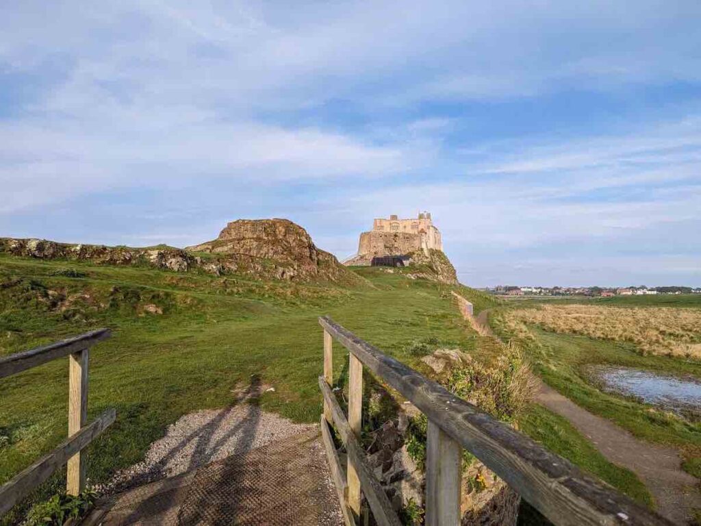
- Continue onwards towards the stone wall, with Lindisfarne castle visible in the distance. The cliff edge is eroding so take care on the path.
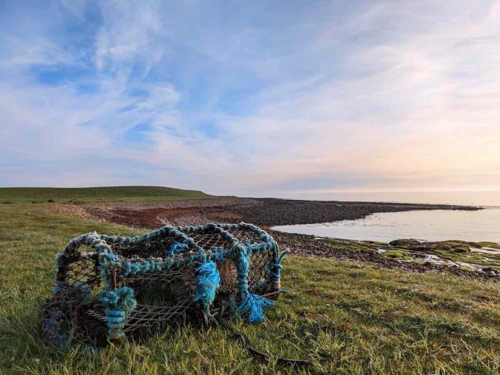
- Head on the long stretch to Lindisfarne Castle, passing another rocky beach, lined with lobster and crab pots. Fishing has been central to life on Holy Island in Northumberland for centuries.
- The path will eventually veer right after a field with livestock, onto an embankment.
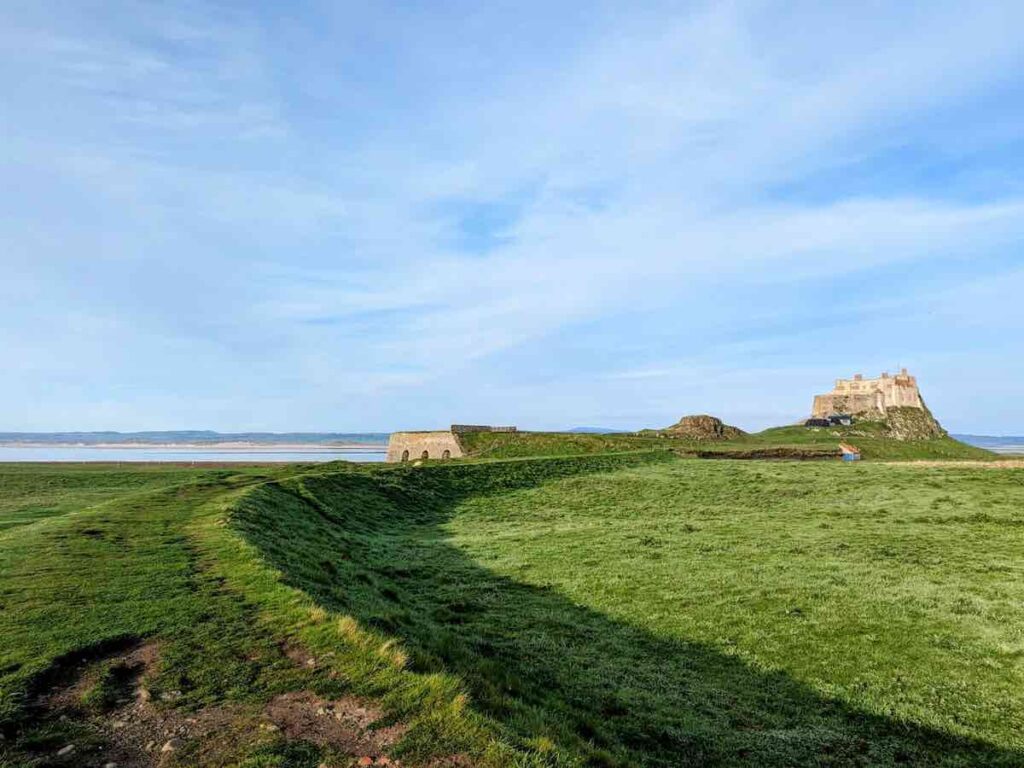
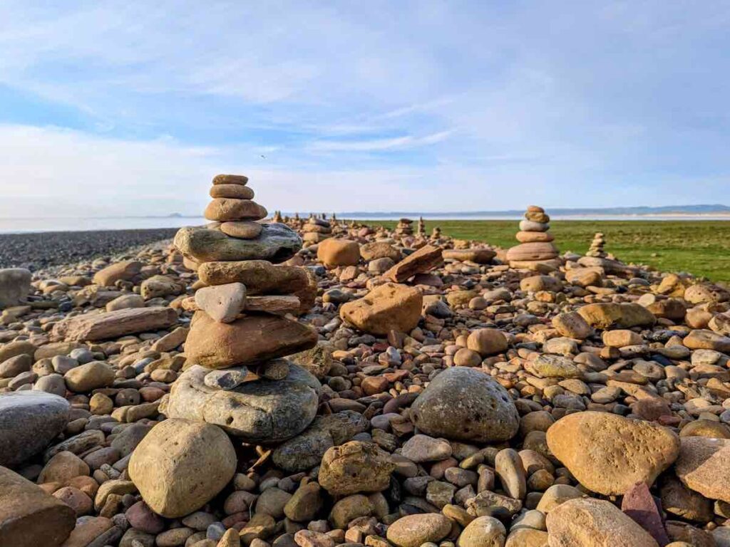
- Turn left before the embankment, towards the pebble beach. You’ll encounter a collection of stone cairns – a man-made tower of carefully balanced stones. Whilst a good photo opportunity (as evidenced below), resist the temptation to add your own, as moving stones to create cairns can disrupt soil structures and contribute to erosion. In the distance you’ll see Bamburgh Castle and The Farne Islands.
- Rejoin the embankment crossing the bridge over a section of the old Holy Island Waggonway – a former network of tramways used to transport coal, iron ore and limestone across the island. Here you’ll see Lindisfarne Castle kilns, where the lime from Nessend quarry you’ve passed was processed, including being used in mortar to build Lindisfarne Priory. The remains of two jetties show how the island would export the end product up to Scotland.
- Approach the castle, keeping it to your right. Sights to note, include the Gertrude Jekyll designed walled garden a few hundred yards on the right and the harbour on your left. Lindisfarne castle was built to guard the harbour entrance. The sixteenth-century castle sits atop the Whin Sill, a tabular layer of the igneous rock dolerite that runs across northern England. It also offers a fantastic vantage point, however be careful on the steep banks. The village, your next destination, clearly visible in the distance. Follow the path through the kissing gates, onto the road. The upturned boats that line it are reminders of the herring industry that once supported the local population.
- Choose to head through the village to Lindisfarne Priory ruins (pictured below) taking in St Cuthbert Island for the 10km route, or take the first right turning in the village (Sandham Lane), taking the first left, then right turn, to head back to the starting point car park to complete the 8km loop.
And that’s it, a very memorable circular route taking in Holy Island’s picturesque dunes, beaches and castle. With the Holy Island circular 10km complete, now it’s time to take on Europe’s best running trails.
Some housekeeping when visiting Holy Island
- Leave no trace – take your rubbish with you and do not take mementos
- Respect the tide – there are numerous stories of people and cars getting stuck; if in doubt, wait until the next safe crossing time
- Shake off Pirri-pirri as it hits your clothing – the invasive plant threatens native plants if carried from one part of the island to another
- Use the dedicated car parks – please don’t park in Holy Island village itself
- Keep dogs on leads – to minimise disturbance to birds and grazing livestock
- What else? Do not use any mountain bikes, camp or light BBQ fires
Holy Island FAQs – how to arrive safely, what to see, where to stay
Land and water meet to create the 3500 hectares of dunes, saltmarsh and mudflats
of the Lindisfarne National Nature Reserve, home to a fascinating array of wildlife. This includes seals, birds (puffins, waders, waterfowl), and butterflies, which attract many visitors.
Yes, Holy Island rivals Framborough Head for bird watching. The sand and mudflats around Lindisfarne are the biggest in the North East of England. As such, they’re popular with migratory birds, with 330 species on record. This includes puffins, waders, waterfowl and birds of prey. The island is designated a National Nature Reserve and Special Protection Area for birds.
Six species are considered internationally important: light-bellied brent goose, greylag, pink-footed goose, wigeon, grey plover and bar-tailed godwit.
Yes. Grey seals make an appearance on the various sandbanks that appear between tides on Lindisfarne. They start to appear on Farne Islands from late February and early March, and can be found near Holy Island until Winter.
Good seal watching spots on Holy Island include the North of the island and St Cuthbert’s Island, by the ruined priory.
Lindisfarne National Nature Reserve is blessed with 3500 hectares of dunes, saltmarsh and mudflats – home to a rich variety of plant-life. This includes Grass of Parnassus, Viper’s Bugloss, 11 species of Orchids, and Lindisfarne Helleborine, which is unique to the island.
Holy Island comes from its history as an important site of early Celtic Christianity, dating back to 634 AD when King Oswald gave the Holy Island of Lindisfarne to St. Aidan to establish his monastery. The remains of Lindisfarne monastery continue to draw pilgrims today.
The monks left Lindisfarne after a series of Viking attacks. In 793 AD, the Vikings looted the monastery and killed or enslaved many of the monks. It was the first time the Vikings had attacked a monastic site in Britain, sending shockwaves around Europe. Some Anglo Saxons even claimed the monks of Lindisfarne were being punished by God for some unknown sins.
In 875, the decision was made to leave Lindisfarne for good.
Lindisfarne continued as an active religious site from the 12th century until the Dissolution of the Monasteries in 1537.
Driving takes across Holy Island tidal causeway takes approximately 10 minutes. Check the safe crossing times published by Northumberland county council before you travel.
Walking across Holy Island causeway takes about 2 hours. If on foot, ideally set off two hours before low tide. Never cross against a rising tide.
Twice-daily tides make access to the mainland possible for only 14 hours a day.
TD15 2SE – Chare Ends visitors car park is the biggest car park on the island with 1000 spaces. There’s no barriers but paid opening hours are 08:00 – 18:00, Monday to Sunday.
According to local legend, St Cuthbert would escape here for quiet prayer. Keen eyes will spot a cross on St Cuthbert Island.
– Crown & Anchor
– The Ship Inn
– Lindisfarne Inn Restaurant & Bar
Stop in for a Lindisfarne Mead. And, if you’re in the area for a day or more, I’d also recommend a trip to Seahouses. The Bamburgh Castle Inn has unbeatable views and pours a good pint.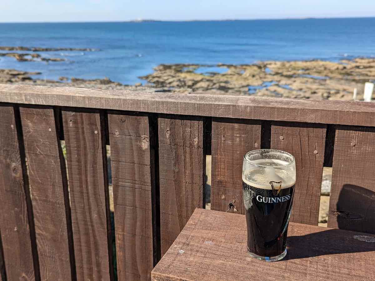
Holy Island is 3km long and 1kmwide. Circular routes around the island range from 8km to 16km.
A minimum of two hours to take in the main historic sites (e.g. Lindisfarne priory, the castle, Emmanuel Head daymarker, lime kilns, and beautiful beaches) at a leisurely pace.
Holy Island is free to visit, however there is paid car parks for visitors and some English Heritage & National Trust historic sites command an entrance fee.
The Northern Lights (Aurora Borealis) are occasionally visible on the Holy Island of Lindisfarne.The island of Lindisfarne is located at the Northmost point of England, and neither the island or its nearest town – Berwick-upon-Tweed – has any light pollution. The best chance of a seeing the Northern Lights on Holy Island is between September and April.
Yes. There are a small number of accommodation options on Holy Island, including B&Bs, hotel rooms and holiday cottages. Staying overnight allows you to see life as an islander, when all the tourists and guided walk tours have gone. Plus, I can personally vouch for the glorious sunrises along the Northumberland coast.
Holy Island accommodation gets booked up early in during peak session, so don’t wait around.
For Holy Island parking, I’d suggest Chare Ends car park, which has 1,000 spaces. It is pay and display 08:00 – 18:00, Monday to Sunday. Charges are £6 for 3 hours, up to £9.50 for per day.
No. Sleeping, cooking or camping is strictly prohibited in the car parks on Holy Island. The nearest campsite to Holy Island is the Barn at Beal, approximately 4 miles away on the mainland.
St Cuthbert’s Way is a 62 mile trail between Melrose in the Scottish Borders and Lindisfarne Island on the Northeast coast of England. It is ancient pilgrimage route, linking several sites associated with St Cuthbert, retracing his monastic career and end up in this important centre of Celtic Christianity. Most walkers complete St Cuthbert’s Way in 4-6 days.